Mt. Kinangop

As a warm-up for a hike of Mt Kenya’s Sirimon and Chogoria Routes in March 2021, I spent a weekend in the Aberdares National Park with friends. We set out as a group of five to hike Elephant Hill and then - weather and wellness depending - to continue on to Mt Kinangop. At 3,906 meters (12,815 feet) Kinangop is the second highest point in the Aberdares, after Mount Satima in the north. I’d hike Elephant Hill several times, but never continued past it to Kinangop. We knew it’d be a long day so we set out before first light.

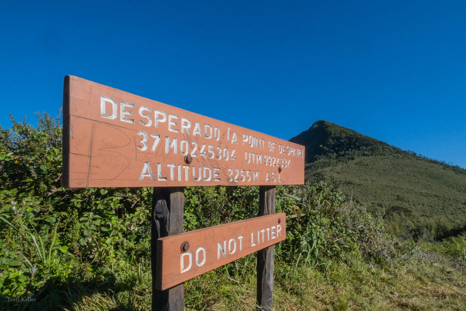
The “point of despair”, where you first get good views above tree line and realize how far you are from the summit. In reality, a lot of people try to do Elephant Hill as a day trip from Nairobi, and if you don’t get an early start you might get to …

The “point of despair”, where you first get good views above tree line and realize how far you are from the summit. In reality, a lot of people try to do Elephant Hill as a day trip from Nairobi, and if you don’t get an early start you might get to this point - after which there is less shade - just as the day is getting very hot. If you’re not to this point by 8 or 9am, you won’t be up to the summit or Kinangop and back by dark.

Not despairing, yet.

Not despairing, yet.

My favorite section of trees on the way up. The hike to Elephant Hill gains a lot of altitude, so you go through several distinctive types of flaura.

My favorite section of trees on the way up. The hike to Elephant Hill gains a lot of altitude, so you go through several distinctive types of flaura.

20210227-BKX35403_web.jpg
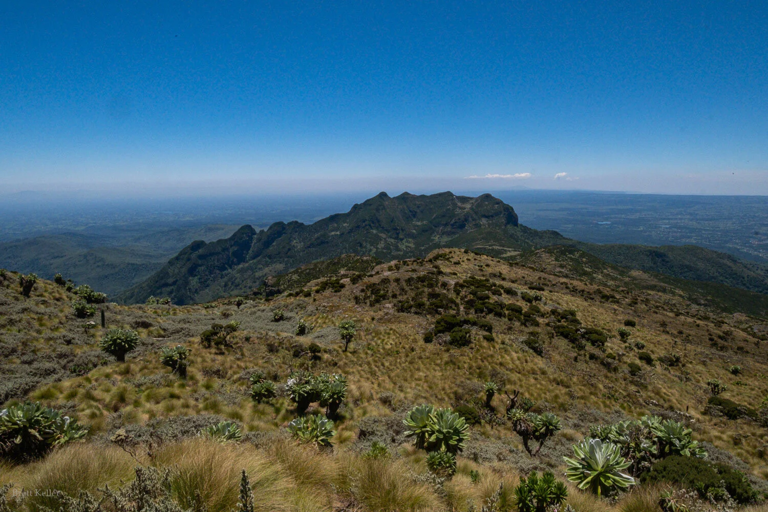
We had extremely clear skies, giving us views all the way across to Mt Kenya - where we’d be hiking in just one more week!

We had extremely clear skies, giving us views all the way across to Mt Kenya - where we’d be hiking in just one more week!

Three of our group summited Elephant Hill and decided to head back to camp, while M and I continued up to Kinangop with our excellent ranger guide, Philemon.

More views of Mt Kenya across the valley on the way up:

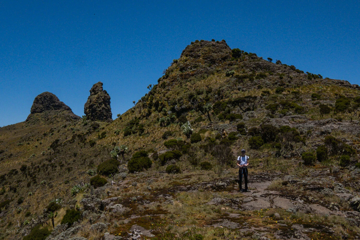
The final summit of Kinangop has three “knobs”, pictured here. The true summit is the final one. You can walk around them to the right (east).

The final summit of Kinangop has three “knobs”, pictured here. The true summit is the final one. You can walk around them to the right (east).

The middle of three summit knobs

The middle of three summit knobs

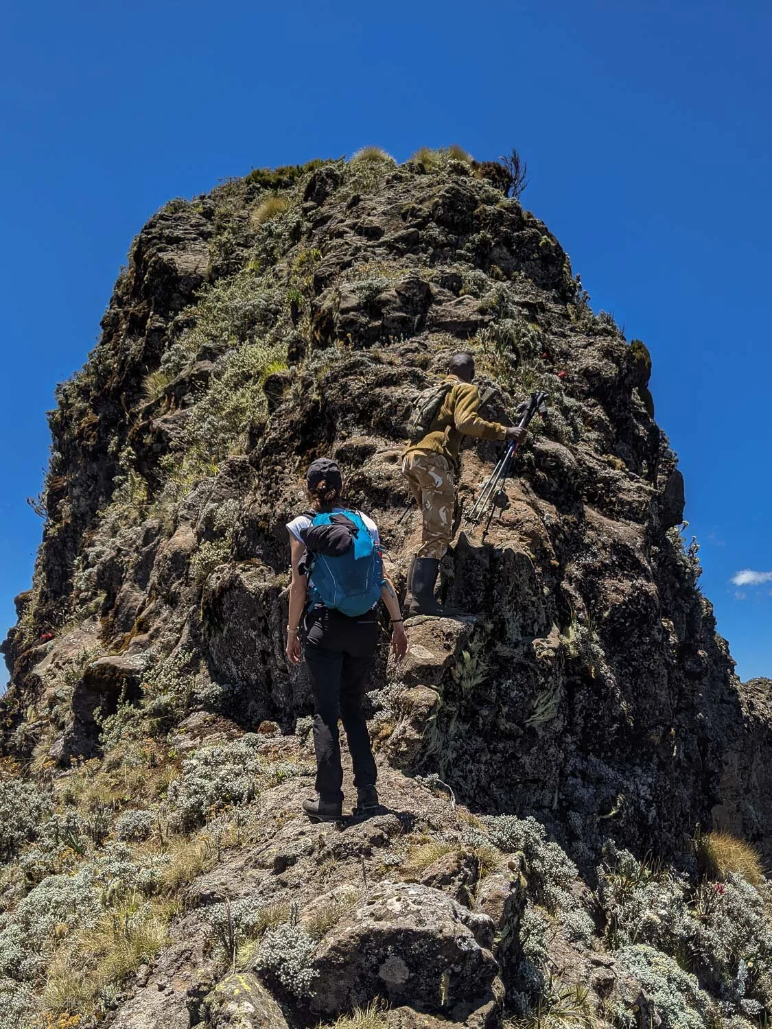
The final summit knob - this is approaching it from the southern (Elephant Hill) side, which is substantially steeper than the north side. If you want a more gradual approach, you can walk around and hike up the north side, though you’ll need to use…

The final summit knob - this is approaching it from the southern (Elephant Hill) side, which is substantially steeper than the north side. If you want a more gradual approach, you can walk around and hike up the north side, though you’ll need to use your hands either way - from the south it’s mostly holding onto rock, from the north it’s holding onto giant tussocks of grass.

It doesn’t look quite as steep looking back down…

It doesn’t look quite as steep looking back down…

A few photos from the summit:

On the summit of Mt Kinangop

On the summit of Mt Kinangop

We descended via the Mutarakwa forest station route, rather than back the way we came. This saves probably 1-2 hrs hiking time, and the need to go back up the saddle to Elephant Hill, but also requires arranging transport back to Njabini Gate (where…

We descended via the Mutarakwa forest station route, rather than back the way we came. This saves probably 1-2 hrs hiking time, and the need to go back up the saddle to Elephant Hill, but also requires arranging transport back to Njabini Gate (where the Elephant Hill hike normally starts) if you need to return there.

Our ranger Philemon saw one (live) elephant far in the distance, but we couldn’t make it out. But we saw plenty of elephant droppings and footprints, this one elephant skull, and lots of sign of buffalo as well.

Our ranger Philemon saw one (live) elephant far in the distance, but we couldn’t make it out. But we saw plenty of elephant droppings and footprints, this one elephant skull, and lots of sign of buffalo as well.

20210227-IMG20210227144356_00_web.jpg
Hiking down the Mutarakwa side, for part of the path we were stepping around elephant footprints like this one.

Hiking down the Mutarakwa side, for part of the path we were stepping around elephant footprints like this one.

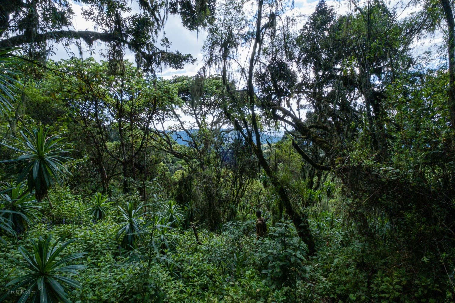
The lower forest on the Mutarakwa side is very beautiful
The lower forest on the Mutarakwa side is very beautiful

Uganda is beautiful
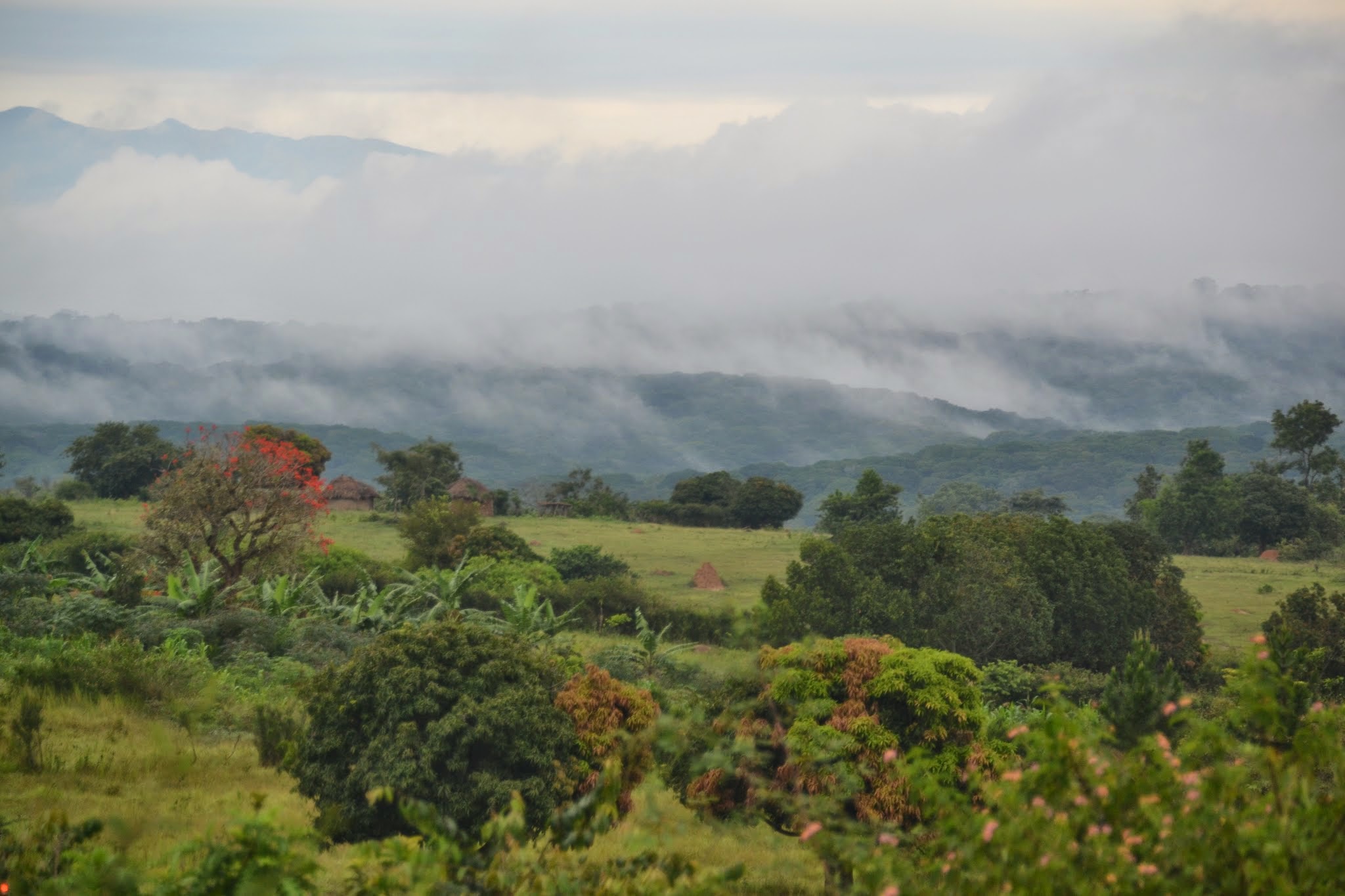
I've been in Uganda the last few weeks helping with the implementation of a large scale survey: a representative national household survey and survey of drug retailers and healthcare providers, all focused on the availability and usage of essential medicines for childhood illness. The system we've set up is pretty cool, with data collection on Android tablets via ODK meta and real time checks for data quality (by teams, individual interviewers, and individual interviews) and feedback to the survey group, which I hope to write up at a later date. In the meantime, I wanted to share some photos of Uganda, which is really, really beautiful. There's a whole album here, and below are some highlights:


Overheard in Maseru

Last Friday afternoon I was leaving Lesotho via the Maseru airport. An African gentleman -- country unknown -- was standing in front of me in the short line for the immigration passport check. The immigration officer greeted the man in Sesotho, asking him a question. From behind his body language seemed confused, and then he asked a question in English. The immigration officer said, "Oh! You are not Basotho. I mistook you for one of my brothers."

"No, no," laughing. "But I am still an African. We are all brothers."

He takes his passport, examines it, and stamps. "Yes, we are brothers."

"We have the same problems, so we are brothers."

"Yes, we do have those."

Travel tips

I've put together a list of tips and suggestions for travelers, drawing on advice from colleagues and friends. It's geared towards public health or development folks who work in and often travel between low-income countries, as opposed to backpackers, tourists, etc.  The document is in Google Drive so I can continuously update it with suggestions -- feedback is appreciated. Another good resource is How to work in someone else’s country by Ruth Stark, which is written with global health consultants in mind, and contains useful packing advice and good general rules for cross-cultural work. Chris Blattman has written quite a bit about this; see especially his posts on air travel, air travel pt 2, packing, and packing pt 2.

Tanzania readings and resources

My recent post asking for tips on what to read on Tanzania and Dar es Salaam yielded some great emails. I've compiled the recommendations and am sharing them back here: Books:

Papers:

  • Bjerk, Paul K. "Sovereignty and socialism in Tanzania: the historiography of an African state." (PDF)
  • Lal, Priya. "Self-Reliance and the State: The Multiple Meanings of Development in Early Post-Colonial Tanzania."

News:

Blogs:

No recommendations so far, alas. Anyone?

Food:

  • quick local bite: Chef's Pride on Morogoro Road
  • Lukas Bar on Chole Road
  • Al Basha (good Lebanese food)
  • Al-Qayam
  • Badminton Club and Retreat (Indian)

Travel and sights:

  • In Dar: The National Museum (on Sokoine Street). I actually visited this already and found it quite interesting, especially the exhibits on history and rock art.
  • "Zanzibar and Pemba are affordable and gorgeous and filled with history"
  • "Mikumi is a less expensive game park if that is your thing"
  • Arusha and Kilimanjaro
  • Kariakoo market (with good Swahili or a guide)
  • Udzungwa Mountains National Park (with camping gear)

Map:

  • "The coolest map remains the really simple photocopied black-and-white line one of the city center that every hotel gives out for free."

Swahili:

  • Get a dictionary and go "to one of the many school supply shops to buy some elementary school Swahili books. These are books designed to teach Swahili to students in the interior who are only generally only hearing Swahili at school (sometimes church), and they'll definitely get you up to speed."
  • Live Lingua has the Peace Corps' Swahili resources.

Taxi conversations (caution: low external validity)

I will try not to generalize too much -- a la Thomas Friedman -- from conversations with taxi drivers to entire cultures or the state of nations, but I thought these three were worth sharing:

  • In Zambia in October, I was asked "In America, who pays the the other family for a wedding, the man's family or the woman's family?" He was aghast that the answer was "neither," although on further discussion of American wedding rituals I conceded that the bride's family does pay more of the costs. This then led to many interesting conversations throughout my work in Zambia.
  • In Kenya this week, I listed to a 20-minute explication on US foreign policy on the International Criminal Court. This lopsided knowledge, where non-Americans almost always seem to know more about US policy than Americans know of other countries' policies, is always a bit surprising, but also an indication that US decisions are felt around the world.
  • In Tanzania last week, I was asked where I'm from. I respond "the US," and often get "which state?" but "Arkansas" yields blank stares. So, I typically say "Arkansas... it's next to Texas" or "Arkansas... it's where Bill Clinton was governor before he became president." This time I went with the latter explanation. The driver paused, and said "Bill Clinton... Yes, I think I know that name. He is Hillary Clinton's husband, yes?"  Progress, there.

Tanzania and Dar bleg

When I moved to Ethiopia I posted a bleg (blog request) asking for reading suggestions: blogs, novels, history, academic papers, etc., and got some very useful feedback -- some in the comments and some by email. I'm moving to Dar es Salaam this week, where I'll be continuing my work with CHAI but living a bit closer to the projects I'm working on. I'm interesting in reading broadly about Tanzania, and also specifically about Dar. I'd love to hear any suggestions you have for the following:

  • History books - Dar-specific, Tanzania-specific, or regional
  • Novels
  • Academic papers
  • Blogs / news / RSS to follow
  • Swahili resources (I already have several books and audio guides, but I'm curious what media others have watched or activities you've done that facilitated learning Swahili)
  • Must-see travel destinations, must-eat foods, must-do activities
  • Cool maps
  • Tanzania data sets / sources I should be familiar with?

I may report back with my own ideas after I've settled in a bit.

Update: read the recommendation I've received so far.

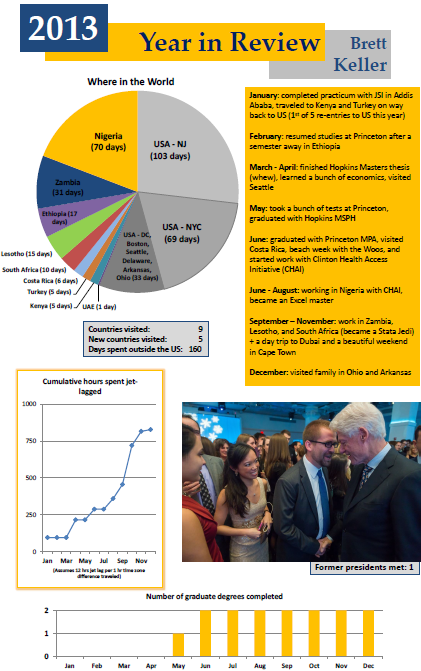
Year in review - infographic style!

It's been about six months since I wrote a real blog post other than a link round-up. One of my 2014 resolutions is to write more regularly -- either for this blog or for myself -- and I'm calling on you, blog readers, to hold me to it. In the meantime, I wanted to share a bit about what it was that kept me too busy to blog. It was a jam-packed year between finishing school, starting a new job, and traveling for fun and for work. At some point in the fall I made a pie chart of where I had spent time so far in the year, and that led to the idea of doing a holiday greeting card in the form of an infographic. I put one together over the holidays and share it with friends and family -- it's supposed to be a bit over the top and tongue in cheek, and it might just become an annual tradition, though future versions will have much better metrics. Click for the PDF:


I also updated the Photography page with links to these albums from 2013: EthiopiaCosta RicaCape Town, and Lesotho. I'm sure there's a better way to present some of these, so suggestions in the comments for integrating photography into a blog are welcome.

Comparisons

It’s hard for me to experience Nigeria without comparing it – mentally, and probably too often, verbally, with Ethiopia. Or rather, comparing Abuja to Addis, since my experience in each country has been centered on the capital. A few thoughts with a broad brush stroke: compared to Addis, Abuja is hotter (lower altitude), the roads are much better (oil wealth? planned city?), the taxis and most cars are newer (less massive import taxes?), the driving is much more aggressive (cars that can actually go fast + fast roads), the upscale grocery stores have amazing selection (more Nigerian buying power?), and security and crime are much greater, ever-present concerns. The music is better (sorry, Teddy Afro) and the conversation louder. The international scene here is more British, more male, and – especially outside of Abuja – more ensconced in all-encompassing compounds called “life camps” run by big foreign oil and construction companies that, like NGOs, often have 3-letter acronym names that have long outlived their original meaning.

Friday photos: Somaliland

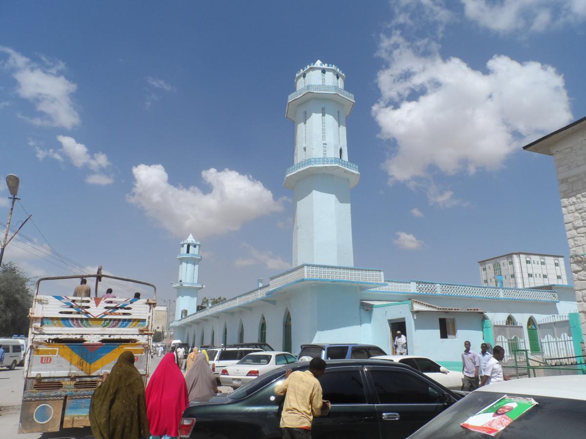
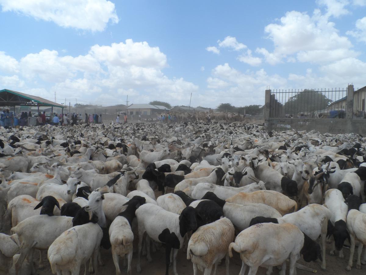
I have lots of thoughts on my trip about one month ago to Somaliland, as it's a fascinating place -- highly recommended in particular for students of public policy or development. But those will have to wait for future posts as I'm swamped for now with work, my Masters thesis, and some other projects. In the meantime, this is Hargeisa:

Above, a major mosque. Below, the street scene downtown:

The animal market:

And here's me with a moneychanger and stacks of Somaliland shillings:

Ethiopia bleg

Bleg: n. An entry in a blog requesting information or contributions. (via Wiktionary)

Finals are over, and I just have a few things to finish up before moving to Addis Ababa, Ethiopia on June 1. I'll be there for almost eight months, working as a monitoring and evaluation intern on a large health project; this work will fulfill internship requirements for my MPA and MSPH degrees, and then I'll have just one semester left at Princeton before graduating. After two years of "book-learning" I'm quite excited to apply what I've been learning a bit.

One thing I learned from doing (too many?) short stints abroad is that it's easy to show up with good intentions and get in the way; I'm hopeful that eight months is long enough that I can be a net benefit to the team I'll be working with, rather than a drain as I get up to speed. I plan to get an Amharic tutor after I arrive -- unfortunately I figured out my internship recently enough that I wasn't able to plan ahead and study the language before going.

I'm especially excited to live in Ethiopia. I have not been before -- this will be my first visit to East Africa / the Horn of Africa at all. I'll mostly be in Addis, but should also spend some time in rural areas where the project is being implemented. I've already talked with several friends who briefly lived in Addis to get tips on what to read, what to do, who to meet, and what to pack. That said I'm always open for more suggestions.

So, I'll share what I've already, or definitely plan to read, and let you help fill in the gaps. Do you have book recommendations? Web or blog links? RSS suggestions? What-to-eat (or not eat) tips? Here's what I've dug up so far:

  • Owen Barder has several informative pages on living and working in Ethiopia here.
  • Chris Blattman's post on What to Read About Ethiopia has lots of tips, some of which I draw on below. His advice for working in a developing country is also helpful, along with lists of what to pack (parts one and two), though they're obviously not tailored to life in Addis. Blattman also links to Stefan Dercon's page with extensive readings on Ethiopian agriculture, and helpfully organizes relevant posts under tags, including posts tagged Ethiopia.
  • As for a general history, I've started Harold Marcus' academic History of Ethiopia, and it's good so far.
  • Books that have gotten multiple recommendations from friends -- and thus got bumped to the top of my list -- include The EmperorCutting for StoneChains of Heaven, and The Sign and the Seal. Other books I've seen mentioned here and there include Sweetness in the BellyWaugh in AbyssiniaNotes from the Hyena's BellyScoop, and A Year in the Death of Africa. If you rave about one of these enough it might move higher up the priority list. But I'm sure there are others worth reading too.
  • For regular information flow I have a Google Alert for Ethiopia, the RSS feed for AllAfrica.com's Ethiopia page, and two blogs found so far:  Addis Journal and Expat in Addis. (Blog recommendations welcome, especially more by Ethiopians.) There's also a Google group called Addis Diplo List.
  • One of my favorite novels is The Beautiful Things That Heaven Bears -- the story of an Ethiopian immigrant in Washington, DC's Logan Circle neighborhood in the 1980s. It's as much about gentrification as it is about the immigrant experience, and I first read it as a new arrival in DC's Petworth neighborhood -- which is in some ways at a similar 'stage' of gentrification to Logan Circle in the 80s.
  • I've started How to Work in Someone Else's Country, which is aimed more at short-term consultants but has been helpful so far.
  • Also not specific to Ethiopia, but I'm finally getting around to reading the much-recommended Anti-Politics Machine, on the development industry in Lesotho, and it seems relevant.

Let me know what I've missed in the comments. And happy 200th blog post to me.

(Note: links to books are Amazon Affiliates links, which means I get a tiny cut of the sales value if you buy something after clicking a link.)

Afraid

Here are two semi-related articles: one by William Easterly about how aid to Ethiopia is propping up an oppressive regime, and another by Rory Carroll on the pernicious but well-intentioned effects of aid tourism in Haiti. Basically, it's really hard to do things right, because international aid and development are not simple. Good intentions are not enough. You can mess up by funneling all your money through a central regime, or by having an uncoordinated, paternalistic mess.

A couple confessions. First, I'm a former "aid tourist." In high school and college I went on short-term trips to Mexico, Guyana, and Zambia (and slightly different experiences elsewhere). My church youth group went to Torreon, Mexico and helped build a church (problematize that). In Guyana and Zambia I was part of medical groups that ostensibly aimed to improve the health of the local people; in hindsight neither project could have possibly had any lasting effects on health, and likely fostered dependency.

Second, I'm an aspiring public health / development professional, and I'm afraid. I don't want to be the short-term, uncoordinated, reinventing-the-wheel, well-intention aid vacationer -- and I think given my education (and the experience I hope to continually gain) I'm more likely to avoid at least some of those shortcomings. But I'm scared that my work might prop up nasty regimes, or satiate a bloated aid industry that justifies its projects to sustain itself, or give me the false impression of doing good while actually doing harm.

I think the first step to doing better is being afraid of these things, but I'm still learning where to go from here.

Volcanoes & Panoramas

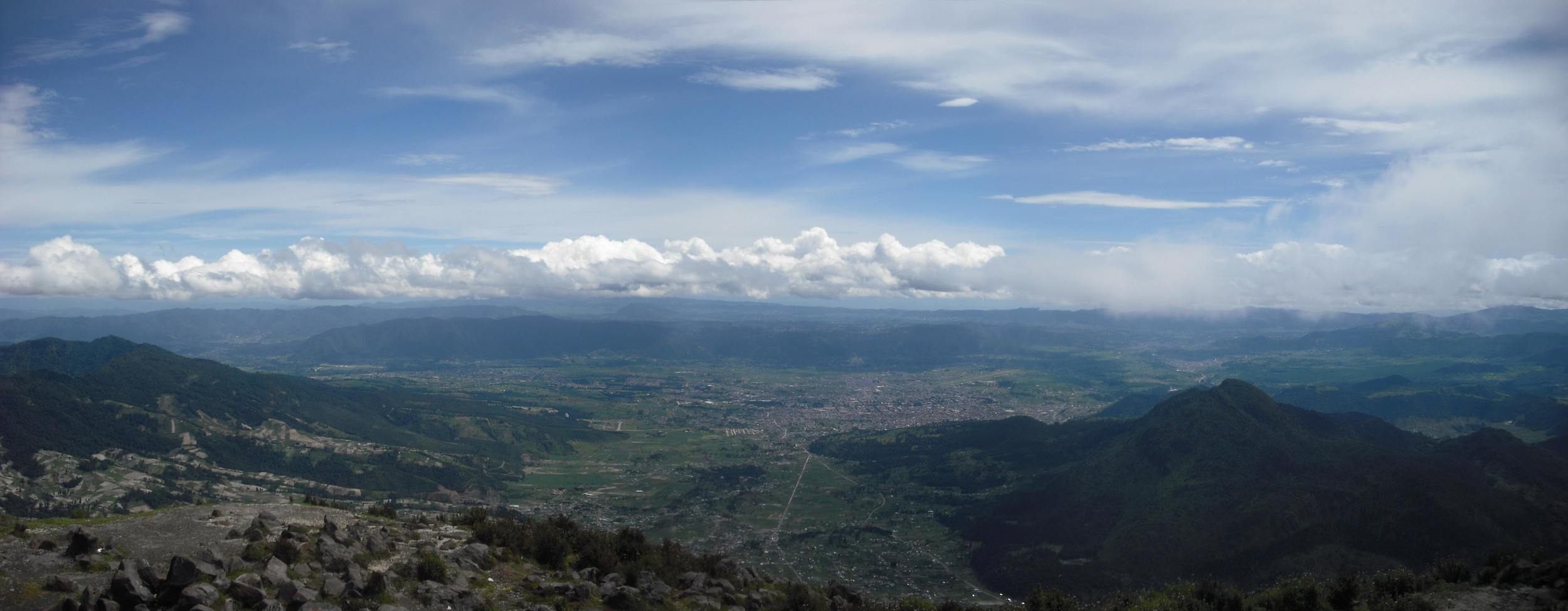
This summer I climbed Volcan San Maria, above Xela (Quetzaltenango), Guatemala, on my second day in town. I took a series of photos from the summit looking back towards Xela, and my dad stitched three of those together using Panorama Maker 4 by Arcsoft. The result (click for the full-size image):

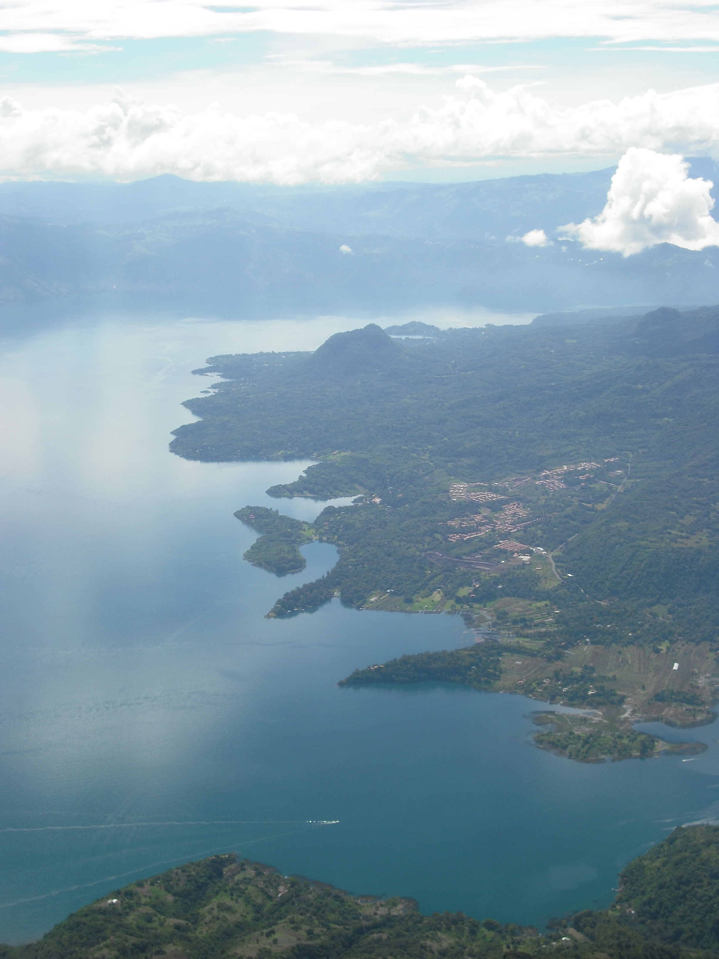
And here are a couple shots from later in my trip, from on top of Volcan San Pedro looking down on the beautiful Lago de Antitlan:
Reboot

As should be obvious now, I got a bit behind on blogging while in Guatemala. I was hopeful that this blog would serve as a reminder to myself to write more regularly, as well as a convenient conduit for sharing travel stories and photos with friends and families. But as I fell more and more behind, I started emailing those stories and photos directly to the friends I felt the greatest need to share them with, and the blog fell behind. I hope to post some photos and additional travel stories from Guatemala in the coming weeks, but mostly I'll try not to make promises I can't keep. So sometimes I'll write about public health and epidemiology, sometimes about politics, about rockets, etc.
I moved to Baltimore about 3 1/2 weeks ago, and a little over a week ago I started classes for a Master in Health Science (MHS) in Global Disease Epidemiology and Control (GDEC) through the Department of International Health at the Johns Hopkins Bloomberg School of Public Health. That's the longest name for a program ever, so we mostly just call it an "MHS in GDEC." Basically, it's an intensive program in international health, especially the epidemiology of infectious diseases and vaccine development and testing. I'll take classes in Baltimore for 4 terms (one academic year), take comprehensive exams in June of 2011, and then head somewhere overseas for 4-12 months for my practicum. I can come back and take additional classes if I want to, but that's optional. GDEC--the program, the people, the pace--is already awesome, and I expect that it will only get more awesome and intense as it goes.

Arrival, part 2

I changed a bit of money* and then headed to the taxis. Guatemala City is divided into 27 zonas, with the airport in Zona 3 and my destination – and most of the stuff worth seeing – in Zona 10. At the taxi queue I asked a Guatemalan passenger what he thought a fair taxi price was to Zona 10 – the taxi drivers within earshot were unhappy with him for quoting a price when he wasn’t giving rides – and then I was putting my bags in a car, climbing in, buckling up, and locking the doors. Travel – and the stories that come from it – only makes sense in context. New York City would be tame to someone from Beijing, but to a city boy it’s a brilliant cacophony. I tried to imagine what it would have felt like to experience Guatemala City if I’d never traveled. And it’s impossible – everything is comparison:

Good major roads. Well, not good, but better than a lot of places. Fast drivers. A bit crazy. Well, not that crazy. Dull buildings – kind of like Athens, but not that dull. Hilly too, and surrounded my mountains – also kind of like Athens. But green, green everywhere, like Accra. Maybe a bit like Los Angeles, if a map of LA were wadded up so that all the empty spaces in between were filled in with city, and then drenched with ten times as much rain for half the year.

My first stay was a hostel called Quetzalroo, a hostel started by a Guatemalan, Manuel, and an Australian, Jodi, just three months ago. I found them through CouchSurfing.com (more on that later). Quetzalroo is named for the quetzal – the national bird of Guatemala, and the kangaroo, the national whatever of Australia. The hostel was comfy, with dorm rooms – mostly empty the night I was there – a kitchen, a small, sunny eating room, and a computer on which I could email a sure-to-be-worried madre (love you, Mom!).

When I arrived Jodi was about to leave to meet Manuel for his lunch break – he works at the Canadian embassy, doing something regarding Guatemalans who want to move to Canada – so I tagged along. We got Spanish food at a small restaurant (where, like with 90% of the other businesses I’ve patronized in Guatemala, had a TV playing the World Cup) and Manuel introduced me to Guatemala by drawing a map on a napkin, outlining the regions of the country and the must-see attractions. The flip side of the napkin produced a mini-map of Zona 10, also known as a Zona Viva – the “lively zone” and soon – within three hours of landing – I was on my own, walking up a street in the city. A bus belched black smoke on me. Horns blared. Rain clouds threatened. And yet, I couldn’t help but feel great sense of freedom.

I stopped into the massive, immaculate Oakland Mall, which I’m told is one of the largest malls in Central America. Four levels, hundreds of stores, dozens of restaurants, fountains – including one with a constant laser light show – and brands from around the world, but mostly from the US, and to a lesser extent, Europe. Then it was up the road past the hostel towards a few museums inside the grounds of the libertarian university Manuel attended [in our first hour he asked if I’d read Atlas Shrugged]. On the way the threatening clouds starting delivering on their promises and I ducked into a fast food joint to sit out the rain and pour over my Lonely Planet Guatemala section on Zona Viva. Lesson: you brought an umbrella, keep it with you; they don’t call it the rainy season for nothing.

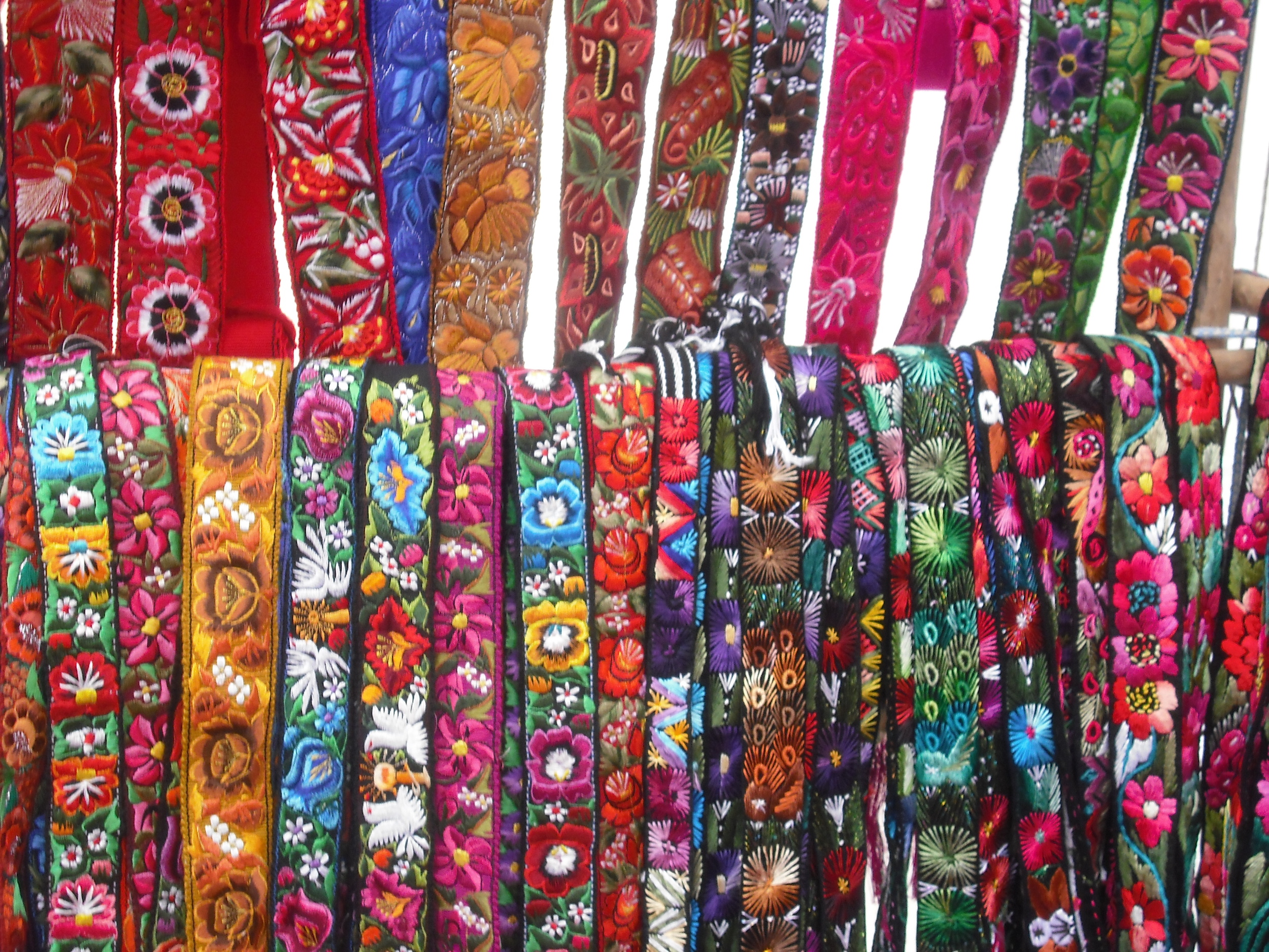
After the rain I hiked down a steep hill to the Museum Ixchel, which presents traditional textiles from throughout Guatemala. I’m not much of a fabric guy, but this was pretty cool. Guatemalan indigenous (ie, Mayan) culture is known for its brightly colored fabrics, which vary from region to region, sometimes with such specificity that Maya can recognize what town someone is from by their clothing. To the outside eye there’s less information to it, and more dazzle.

I didn’t have enough quetzales on me (oops!) to get into Museo Popol Vuh – with archaeological finds from throughout Guatemala, so that one will have to wait until I’m back in the City.

Back at Quetzalroo, I discovered that they had an acoustic guitar, which is (along with alcohol) an important social catalyst at hostels the world over. Turns out Jodi can sing, so we went down the list of 90s classics. The night ended with Manuel and I watching City of God, an incredibly violent and compelling Brazilian film (with subtitles) about the cocaine trade in an impoverished slum of Rio de Janeiro.

What a long day. En manana, necesito tomar un camioneta (“chicken bus”) a Lago de Antitlan.

*A note on money: The current exchange rate is about 8 queztales to the US dollar, which means a 20q bill is about $2.50, and the wad of 100q bills I had were worth $12.50 each. Like the rest of the world, Guatemala is now plastered with ATMs, so getting money isn’t a problem, as long as you have it.

Arrival, part 1

I took the Super Shuttle to Reagan National Airport at about 3:30 in the morning. Since I’d been up late packing, that meant I only slept for an hour or two. That’s OK – I hate flying, so I like to sleep on the plane. [I like to think that my fear of flying comes in part from a vivid, sometimes morbid imagination. While the rational side of me knows the flight is the single safest part of any trip abroad, the imaginative side of me knows that NTSB investigators can determine whether a plane was downed by a bomb in part by analyzing the remains of passengers from different parts of the planes and making a map of their varying degrees of “intactness.”] One of the other Super Shuttle passengers was a brawny guy in his mid to late 30’s. We talked about where we were going; him to Miami, me to Guatemala. He said he worked in retail and it was basically a dead-end job, so he admired my balls (his words) at being able to quit my job, travel and go to grad school for what I’m passionate about. A little bit of travel talk and affirmation makes a 4 AM bus ride go much smoother.

The lines moved fine at Reagan, though in the luggage one I was stuck behind a big church group. You can often tell these groups because they wear obnoxiously colored matching t-shirts, seemed unused to travel in general, and are led by a guy named Pastor Bob (es la verdad!). They were headed to Kingston, Jamaica, for what I’m sure will be an extremely arduous one to three weeks spreading the gospel. I can’t be too negative though – I cut my teeth traveling with mission groups, and it’s a great way to get to environs that most non-church people of similar means rarely reach.

My flight to Atlanta and the transfer were uneventful, and soon I was boarding my plane for Guatemala City. There’s a certain psychological shift when you board an international flight; especially to a new country. Suddenly you’re on a plane that is half Guatemalans and half Americans. Or rather, 50% Guatemalans with lots of things they bought in the US, 30% mission groups in matching shirts, and 20% nondescript persons or soon-to-be mangy backpackers. And then you’re wheels up and there’s no turning back – just a few hours of napping and an optional $8 crummy airplane sandwich (no thanks) away from something completely new.

As we descended into Guatemala City the view from the windows was grand. The clouds only covered half of the sky, and the rest was mountains. Green, rolling mountains, not snow-capped peaks.

Touchdown, and the passengers break into scattered applause. That part never gets old.

(to be continued…)

Packing

Packing for this trip wasn’t too difficult. It’s always easier to pack for a trip where you’ll be in one place for a while. Had I been planning to backpack through Guatemala or elsewhere in Central America for six weeks, the weight and volume of my things would have been a larger concern. Still, I wanted to be able to carry everything fairly easily. So, I packed in my medium-sized North Face backpack – the one I’ve been traveling with for years now – and a duffel bag. I also brought along a smaller backpack (I picked it up at a thrift store) that’s perfect for day trips. My clothes are good for layering, from a swimsuit and running clothes to a few long sleeve shirts and a heavier sweater. Xela is at 7,800 feet and it’s the rainy season, so the weather is cold (but not freezing) and a lot of water falls from the sky. Then there are toiletries and snacks – for the trips and for when I’m just tired of tortillas. I also brought a few notebooks and a Spanish dictionary and a phrasebook. Books I brought included Rigoberta Menchu’s autobiography (about Guatemala), the Bourne Supremacy, Black Lamb and Grey Falcon (about the former Yugoslavia), In the Wake of the Plague (about Europe), and of course, Lonely Planet’s Guatemala guide book. At the bottom of my duffel bag is my epidemiology textbook, in case I get tired of studying Spanish and want some stats for a change.

The largest single item I packed is a used Dell laptop I picked up for $100 on Craigslist. I figure if it gets stolen, it’s no great loss, but it will allow me to write about my travels as I go. And if I get through the trip with it in one piece, I can sell it in Xela or Guatemala City or back in the states on Craiglist, likely for as much as I bought it for. It’s much nicer to write at a relaxed pace when I get the chance, save the documents to a tiny thumb drive I carry in my money pouch, and transfer it to a computer at an Internet café.

I’ve got two digital cameras – one a point-and-shoot that fits in a front pocket, the other a slightly nicer point-and-shoot with a more rounded profile and a decent zoom. I decided to leave the larger one at home for two reasons: the larger camera is more likely to get stolen since it’s harder to conceal by slipping into a pocket, and it eats up AA batteries at a steady clip.

As I travel, I keep a small notebook with me - it’s about 8 inches tall and 4 inches wide. It’s the perfect size to keep handy and jot down observations: the way the mist came over that mountain, the way the cobrador swings in the back of the chicken bus...

I finished packing, sewing up a few holes in my backpacks, and sending final emails at about 1:00 in the morning the night before my flight...

Numbers - Week One

I think I will finally have time to write more this evening, and I plan to post about my travels mostly in chronological order. But here´s a summary of my first week: Methods of transportation taken and iterations thereof: planes (2), taxis (2), boat (6), decent bus (1, in DC), chicken buses (7)

People a chicken bus is designed to transport: 40 (10 double rows of seats for 2 people each)

Most people seen on one chicken bus: 67

US dollars paid for a Guatemalan cell phone: 19

Children in my host family: 3

Family members at the house the evening I arrived: 9

Nationalities met so far: 9 (Guatemalan, American, Canadian, Danish, Swedish, Australian, Italian, British, Irish... and I´m sure I´m missing some!)

Here

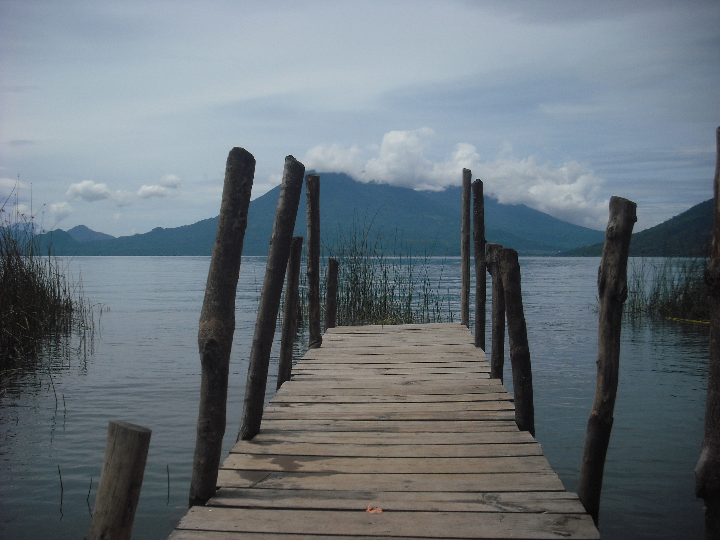
I arrived in Guatemala City on Tuesday afternoon, spent Tuesday night there, and then took the chicken bus up to Lago de Antitlan. I spent the last two nights in San Marcos la Laguna on the lake. I don´t have a lot of time to write at the moment, but I thought I should share a few photos from the trip so far:

More soon...